Night Flight mission flights
LAST MISSION: March 6, 1998 - Flight
north to Lexington
, KY - Conducting initial ops testing of slow-scan hardware package
undergoing development
for deployment on Russian MIR space station.
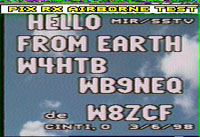
March 6, 1998
With W4HTB, launched to 6,500 feet north to Lexington. The purpose of
this flight was to test
the hardware being developed by W4HTB, W9NTP, W8ZCF and others for the MIREX space
station SSTV project. Images were sent, received, and repeated on 2
meter FM using the Robot 36 mode.
Because of the substantially reduced bandwidth required for SSTV (still
images), range was almost
double that of 439 mhz NTSC. Here are some of the pics thanks to W8ZCF:
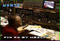
From W9NTP:
From W8ZCF:
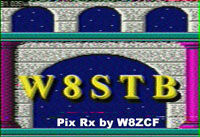
From W8STB:
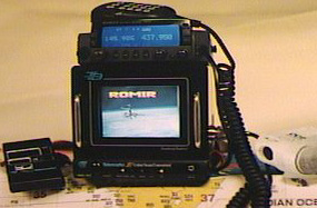
The equipment (less Hank's PIC-based controller):
November 1997
With W4HTB, Hank as co-pilot, we launched to 9,500 feet VFR. Flight
approached Cinncinnatti, with
stations in five states worked Video mode. W8ZCF e-mailed us received
images (on main page).
August 1997
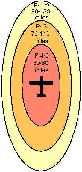
The operational area map for this first flight is shown. On the agenda
are flights into Ohio, Illinois, and south Tennessee. Although capable
of weather flying operation, clear weather simplifies things; mission
schedules posted on this page will therefore be tentative.
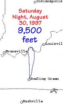 The initial flight was launched at 0115 utc, August 30. Excellent
weather permitted operation under visual flight rules. W4HTB made the
necessary announcements to several other regional ATV stations on very
short notice. Many stations were worked in four states, able to read
the ID graphic, the live cockpit camera video being more difficult. See
below for typical range..
The initial flight was launched at 0115 utc, August 30. Excellent
weather permitted operation under visual flight rules. W4HTB made the
necessary announcements to several other regional ATV stations on very
short notice. Many stations were worked in four states, able to read
the ID graphic, the live cockpit camera video being more difficult. See
below for typical range..